
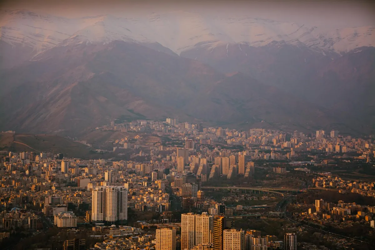
The cultural development of Iran is inseparable from the geographic context of the Iranian plateau. The specific arrangement of mountains, deserts, fertile valleys, and trade routes shaped settlement patterns, political organization, cultural exchange, and intellectual development across millennia. Understanding this geography helps explain what happened in Iranian history that didn't happen elsewhere with comparable cultural intensity. This article documents the geographic framework and its cultural consequences.
The basic geography
The Iranian plateau is a high-altitude region (typically 1,000-3,000 meters) bounded by the Zagros mountains in the west, the Alborz in the north, the Hindu Kush in the east, and the Persian Gulf and Indian Ocean coasts in the south. The interior is dominated by two large deserts (Dasht-e Kavir and Dasht-e Lut) with fertile zones along the mountain edges and in scattered oases.
The arrangement created a particular settlement pattern: cities and agricultural areas clustered along mountain edges where water from snowmelt was reliable, with desert zones between them that were sparsely populated but traversable along established routes.
This produced a culture organized around connected nodes (cities) separated by traversed but unsettled space (desert), connected by routes that were predictable, defensible, and relatively few. Trade and communication followed these routes; cultural exchange concentrated along them.
The trade route position
The Iranian plateau sits at the geographical center of the major Eurasian trade networks. The Silk Road system passed through the plateau on its main routes between China and the Mediterranean. North-south routes connected Central Asian steppe cultures to the Persian Gulf and Indian Ocean trading systems. Iran was not at the periphery of any of these networks; it was at their convergence.
This position produced cultural consequences. Iranian cities became cosmopolitan in ways that purely peripheral cities could not. Iranian intellectual and artistic traditions developed through continuous contact with traditions from China, India, the Arab world, the Mediterranean, and Central Asia. The Persian cultural achievement is partly the product of this sustained cosmopolitan exchange.
The defensive geography
The mountains that define the plateau also defended it. The Zagros and Alborz ranges are formidable barriers; invasion from west or north required crossing them. Throughout Iranian history, this geography both enabled defense against invasion and produced the political units that could exploit defensible terrain.
When invasions did occur (Greek, Arab, Mongol, Turkish, others), the plateau's geography shaped both the conquest and the subsequent cultural integration. Conquerors who took the plateau typically incorporated rather than replaced existing cultural traditions, partly because the geography made wholesale replacement impractical.
The water question
Water availability shaped Iranian settlement patterns absolutely. The qanat system (underground channels carrying water from mountain aquifers to lowland fields) is among the most-sophisticated pre-modern water engineering anywhere. Iranian cultural development was made possible by qanat-supported agriculture in zones that would otherwise have been uninhabitable.
This produced specific patterns: city sites determined by water availability; agricultural areas extending only as far as qanat systems could reach; political units organized around water control; cultural traditions celebrating water as fundamental cultural symbol.
The Persian garden tradition emerges directly from this water context. The ideal garden of Iranian tradition (charbagh — four-quartered garden with water channels) is a celebration of water in a landscape where water was precious and engineered. The form is not arbitrary; it's shaped by the geographic reality of water scarcity.
The cultural consequences
The Iranian plateau's geography produced specific cultural patterns:
Urban civilization with rural connections. Iranian culture is fundamentally urban, but the cities exist in continuing relationship with rural agricultural zones and pastoral peoples. The cultural traditions blend these elements rather than separating them sharply.
Trade-based cosmopolitanism. The Iranian cultural tradition has always been outward-looking and cosmopolitan, drawing on multiple external traditions while maintaining distinct identity. The geography supported this.
Defensive resilience. Iranian cultural identity has survived multiple conquests partly because the geography that enabled invasion also constrained what conquerors could do once they arrived. The cultural tradition adapted to incorporate elements from invaders rather than being replaced by them.
Water-conscious aesthetics. The cultural celebration of water, gardens, fountains, and irrigation reflects the geographic reality of water as precious resource. The aesthetic priorities are partly geographic in origin.
Connected diversity. The plateau's arrangement of connected nodes produced a civilization that was diverse across regions but connected through trade routes and political integration. Regional diversity within cultural unity is a persistent Iranian pattern.
Implications for studying Iranian culture
Engaging with Iranian cultural traditions benefits from geographic awareness. The cultural patterns make more sense against their geographic background. The Persian garden, the urban civilization, the cosmopolitan trade culture, the resilience to invasion — all are partly geographic in origin.
For students of Iranian culture, attending to geography produces interpretive frameworks that purely-cultural analysis misses. The cultural traditions emerged in dialogue with the physical context; understanding the context deepens understanding of the cultural traditions.
The closing observation
The Iranian plateau's geography is not merely background to Iranian cultural development; it is one of the conditions that produced that development. The specific cultural achievements of Iranian civilization — its cosmopolitanism, urban character, water-conscious aesthetics, defensive cultural resilience — are partly geographic in origin.
For deeper engagement with Iranian culture, the geographic framework provides organizing context that purely-textual study cannot replicate.
Source notes
Analysis draws on the published geographical and historical scholarship including Xavier de Planhol, Cultural Areas of the Modern Near East, and the geographic chapters of the Cambridge History of Iran multi-volume series. Qanat documentation references the work of Henri Goblot and the more-recent scholarship in Persian engineering history.